To develop a website to display details about the places around my house.
Create a Django admin interface.
Download your city map from Google.
Using <map> tag name the map.
Create clickable regions in the image using <area> tag.
Write HTML programs for all the regions identified.
Execute the programs and publish them.
<!DOCTYPE html>
<html>
    <head>
        <title>
            Image Map
        </title>
    </head>
    <body >
        <img id="Image-Maps-Com-image-maps-2023-04-20-080930" src="home..jpg" border="0" width="1231" height="925" orgWidth="1231" orgHeight="925" usemap="#image-maps-2023-04-20-080930" alt="" />
<map name="image-maps-2023-04-20-080930" id="ImageMapsCom-image-maps-2023-04-20-080930">
<area  alt="" title="home" href="home.html" shape="rect" coords="612,475,662,525" style="outline:none;" target="_self"     />
<area  alt="" title="medical" href="medical.html" shape="rect" coords="807,558,857,608" style="outline:none;" target="_self"     />
<area  alt="" title="shop" href="shop.html" shape="rect" coords="702,488,752,538" style="outline:none;" target="_self"     />
<area  alt="" title="policestation" href="policestation.html" shape="rect" coords="586,64,636,114" style="outline:none;" target="_self"     />
<area  alt="" title="departmentalstore" href="departmentalstore.html" shape="rect" coords="1003,100,1053,150" style="outline:none;" target="_self"     />
<area shape="rect" coords="1229,923,1231,925" alt="Image Map" style="outline:none;" title="Image Map" href="https://www.image-maps.com/" />
</map>


    </body>
</html>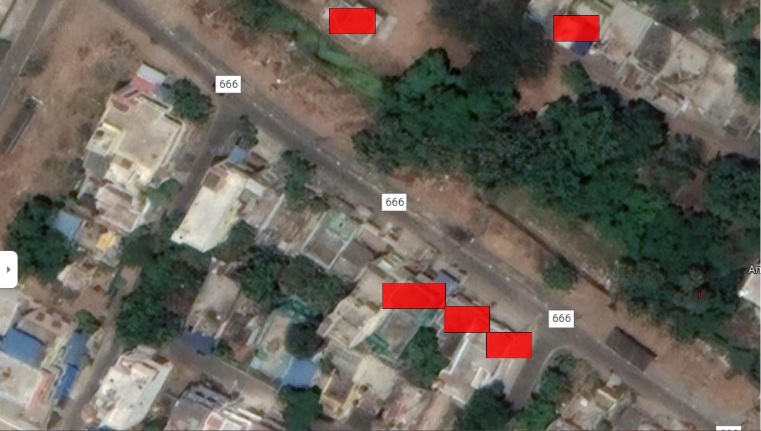
The program for implementing image maps using HTML is executed successfully.