If you find this useful, please consider giving us a star ⭐
Official repo for: ClaraVid: A Holistic Scene Reconstruction Benchmark From Aerial Perspective With Delentropy-Based Complexity Profiling - Accepted ICCV 2025
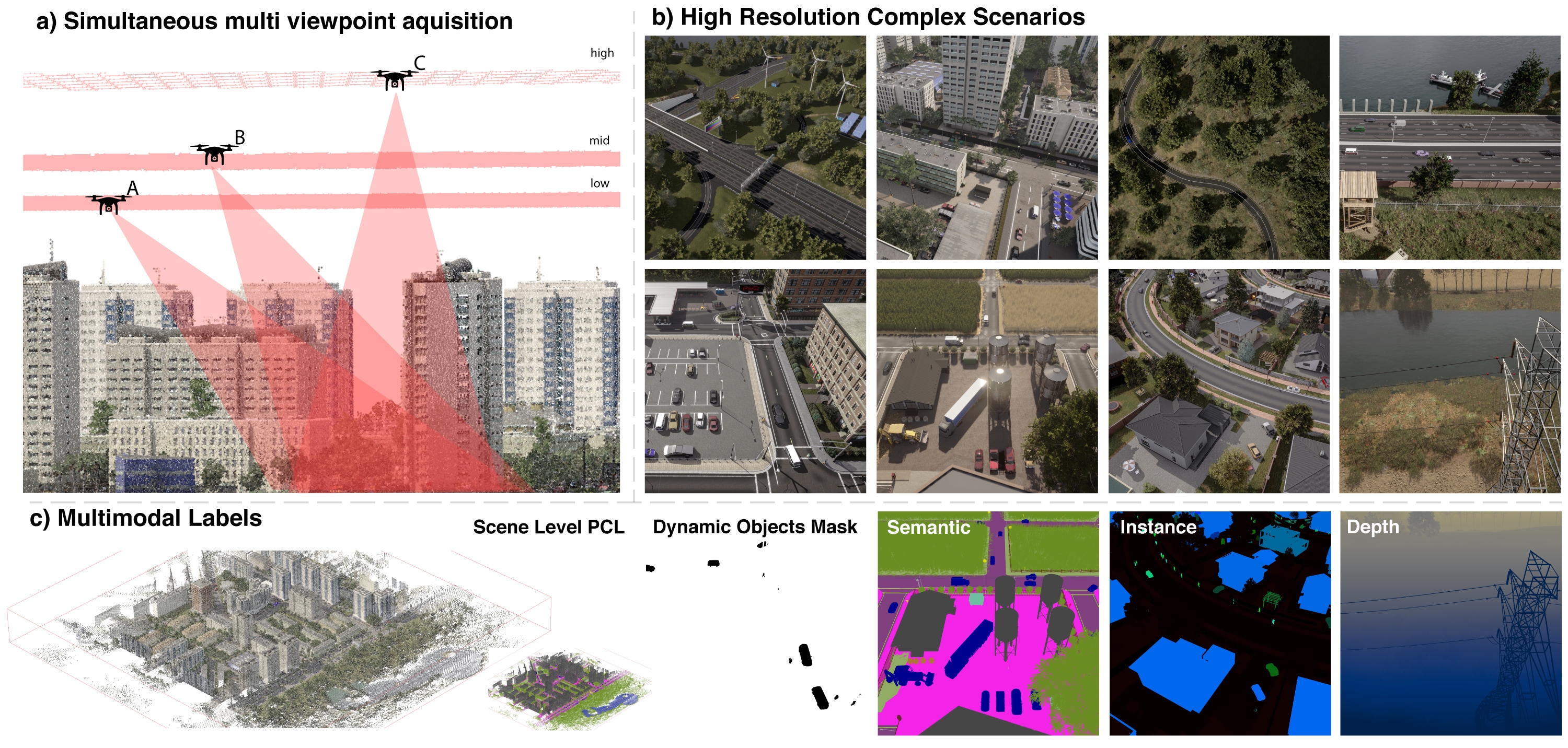
ClaraVid is a synthetic dataset built for semantic and geometric neural reconstruction from low altitude UAV/aerial imagery. It contains 16,917 multimodal frames collected across 8 UAV missions over 5 diverse environments: urban, urban high, rural, highway, and nature.
Delentropic Scene Profile (DSP) is a metric for estimating scene complexity from images, tailored for structured UAV mapping scenarios. DSP helps predict reconstruction difficulty.
- All data uploaded
- Release dataset SDK
- Release pip package
- Release DSP code
- Add Nerfstudio support (after conference)
Easiest way to install this package is to use pip:
# just for dataset interface
pip install claravid

# for dataset interface + complexity profiles of a scene (you will likely want this)
pip install claravid[dsp]

# for dataset interface + complexity profiles of a scene + examples (includes open3d)
pip install claravid[all]
Alternatively you can clone the repository and install it manually:
git clone https://github.com/rdbch/claravid_code.git
pip install -e .

pip install -e .[dsp]

pip install -e .[all]
We provide a script for computing and plotting the complexity profile of a given scene. We support currently 3 complexity functions: delentropy, GLCM entropy and Pixel Shannon entropy. See ./scene_complexity_profile.py for more details regarding the implementation.
# compute and generate DSP plot
$ python ./scripts/compute_complexity_profile.py --input /path/to/input --pattern *.jpg --complexity_func delent

# compute DSP for scene 003_urban_1
$ python ./scripts/compute_complexity_profile.py --input /path/to/claravid/003_urban_1 --pattern left_rgb/**/*.jpg --complexity_func delentWe provide 2 examples for this dataset code base:
In examples/demo.ipynb we provide an example for loading and exploring a scene and configuring the various flight parameters and modalities:
from claravid import ClaravidDataset

dataset = ClaravidDataset(
    root=Path('/path/to/claravid'),
    missions=['highway_1', ],     # see ClaravidMissions
    altitude=['low', ],           # see ClaravidAltitude
    direction=['v', 'h'],         # see ClaravidGridDirection
    fields=['rgb', 'pan_seg', 'depth', ...],
)
data = dataset[0]
{"rgb":..., "pan_seg":..., "depth":..., ...}In examples/pcl_project.py we provide an example for loading the scene PCL and projecting it to back to a certain frame. This serves as an example on how to handle extrinsics, 3D un/projection and manipulating scene pointclouds.
If you found this work useful, please cite us as:
@InProceedings{Beche_2025_ICCV,
    author    = {Beche, Radu and Nedevschi, Sergiu},
    title     = {ClaraVid: A Holistic Scene Reconstruction Benchmark From Aerial Perspective With Delentropy-Based Complexity Profiling},
    booktitle = {Proceedings of the IEEE/CVF International Conference on Computer Vision (ICCV)},
    month     = {October},
    year      = {2025},
    pages     = {26015-26025}
}